Momentous Adventures: Gregory with Hannah and Ace Gap Loop
Gregory Bald
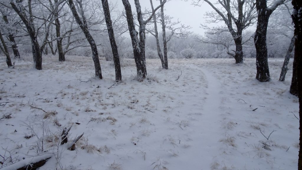
This fantastic 56 mile loop has the goods, a huge Bald, lots of ridge walking with open view points, remote river valleys teaming with wildlife. Some of the trails are mostly flat and easy going while other climbs like up to Gregory Bald or the accent to gain Rich Mtn’s ridgeline are quite challenging. The thing that makes this loop special is that every day features the whole gamut of wilderness settings that make the Smokies special. There is only one clincher for the inexperienced hiker, a unbridged crossing of Abrams Creek, a mid thigh ford through moderate current that is about 80 feet across in low/regular water levels. I would not suggest this crossing in spring or during a period of rain soaking thunderstorms, simply save it for another time. Start out by driving out to Cades Cove’s info kiosk at the start of the loop and park. Backtrack into the campground while sticking to the right towards Anthony Creek TR. Start up the Creek and take the right split on the Russell Field TR. onwards and upwards to the A.T. Make that right when up on this legendary trail and ride the ridge past Mollie’s Ridge Shelter and the Gregory Bald TR. to spot #113 at Birch Spring Gap. My favorite camps here are the one’s to the left of the holler perched on old tent platforms that were carved into the hillside, if you keep taking the camp trail to the left it will lead to the top ledge spot. Cook up some dinner and soak in this quiet perch as the sun fades into a starry night.
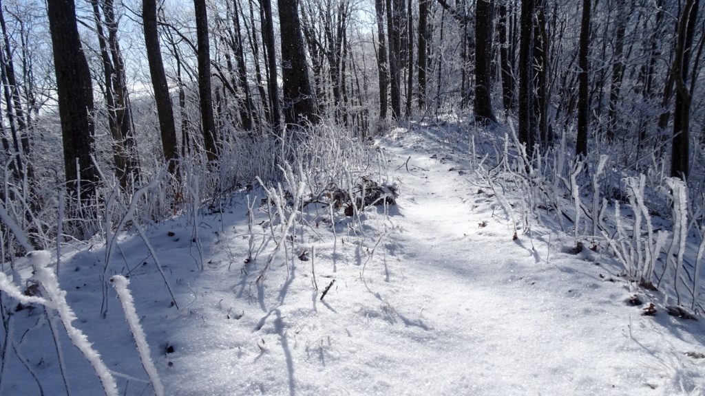
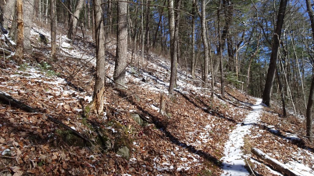
An icy A.T. by #113
Wake up after a restful night’s sleep and think about these two options. You can backtrack 2+ miles back to the Gregory Bald TR. and keep on the ridges to the Bald while saving a couple of miles or continue on the A.T. south to Twentymile TR. I have been sculpting these past winter’s hikes to get close (or on) the Park’s boundaries, so I took the latter option and I hate backtracking. Taking my route, you can also go up the old Shuckstack fire tower too, just keep in mind that you have a fair bit of climbing today and make a decision based on daylight hours, itinerary and energy level. Make that on Twentymile and then another right up the Long Hungry Ridge TR, a very nice trail. The first part of the Ridge is following a creek, the second part climbs and levels off for a traverse up to Rich Gap and the start of this epic Bald. Make that left on the Gregory Bald TR. and enter the Bald proper as the views open up all around. This giant Bald has many tiny and large meadows mixed in with tons of Roadies, Mtn. Laurel and Flame Azalea bushes. Imagine this area alive with color come June, having a picnic lunch and soaking in the goodness with that special someone. Roll up on camp spot #13 next at Sheep Pen Gap before the slow decent to Parson Branch RD. When you arrive at Panther Gap, get a good view towards the landscape in the northern part of the Range and down to Cades Cove. Hit the Road and cross it to find the remarkably flat Hannah Mtn TR. This Ridgeline is like a thoroughfare to the northern side of the Park for animals and people alike. Traverse this lovely Ridge before spotting the obvious dip in the land, this is Flint Gap, your camp for the night. When at camp, walk behind you into the tornado battered forest and down the hill to the right to find the water source.
Still a couple of weeks from peak bloom…
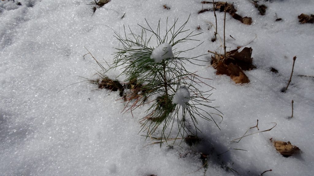
A little Hemlock sapling holds a few tiny puffs of snow
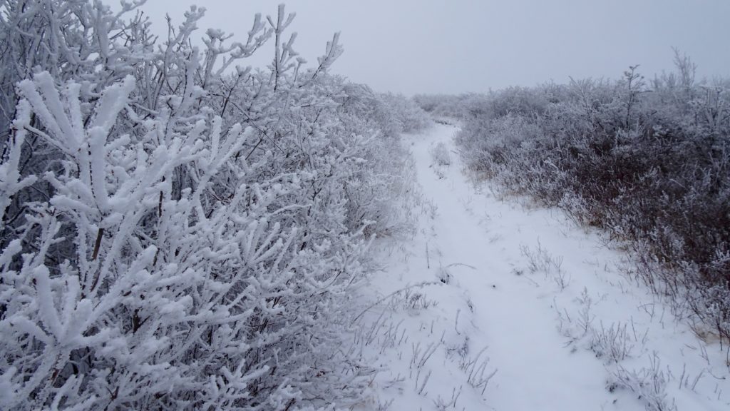
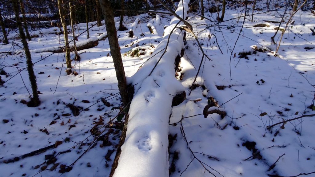
The snows lightening up on Hannah Mtn.
After waking up in this delightfully quiet area, enjoy a nice cup of coffee as the birds chatter away in the trees. Pack up your pack and head slowly downhill to Scott Gap and stay on the Hannah Mtn TR. Start a more rapid decent to the unbridged crossing of Abrams Creek as it winds it’s way down from Cades. From this spot, I found the safest spot to cross was 10 feet to the right where the deepest pools were more shallow and the rocks less slaby. Although the topograpy here dictates the current to be more lazy, it is still a wide 70 ft. section, just so you know. After crossing this bad bear, take the split to the left as it climbs to a intersection with Hatcher Mtn TR. and make that right. As the trail climbs, take a look behind you to see more tornado damaged forest hanging above Abrams Creek, it is a most dramatic sight. This cool trail climbs up more earnestly before reaching a crest where you traverse for a short bit before dropping down to a three way intersection, stay straight on the Beard Cane TR. At this point it is apparent that you have stepped into deeper wilderness, far away from any major town or trailhead, this is less traveled country. Shimmy down Wedge Ridge to the Creek bottom where this lovely valley opens up. On both sides are fairly steep hillsides that cup this valley and give it a dramatic feel. Look for decommissioned camp #11 on the right where the tornado plowed over the forest and hopped out of this watershed it appears. Past the camp, the forest regains it’s undamaged luster as the tread follows the marsh bed of the creek on and off for the next couple of miles. Beard Cane is my kind of creek, winding gently through the landscape with it’s scenic pools and cascades. Arrive at camp #3 in a nice section of bigger trees with nice views upstream to Ace Gap and Hurricane Mtn.
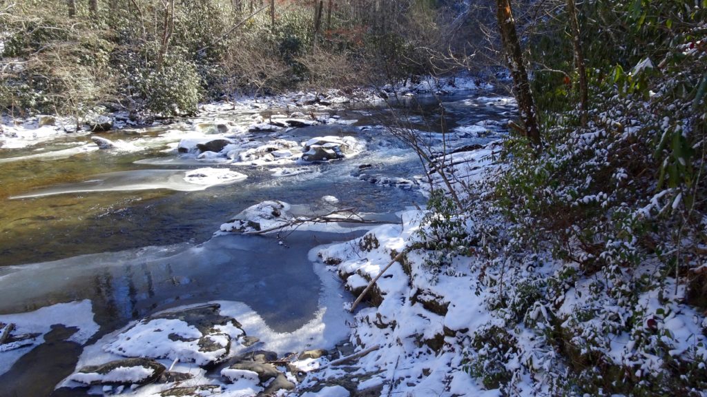
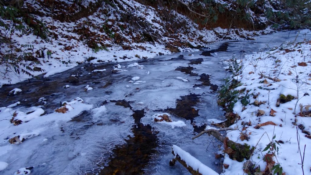
A less than ideal crossing for me at Abrams
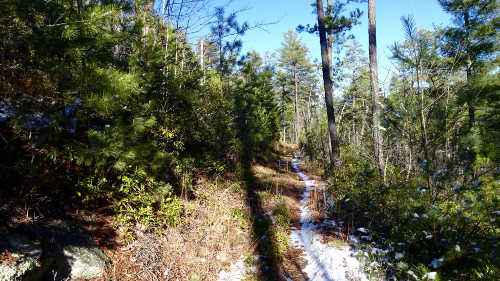
Traversing along Hatcher Mtn.
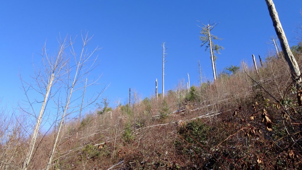
Tornado damage by #11
Curious Coyote tracks along the Creek
Beard Cane Creek
Wake up again to the gentle sound of the Creek and birdsong before taking off for the day. Climb up out of the Creek bottom up to Ace Gap where the trail gently rolls along the ridge past nice hollers on the right and a few random houses on the left. It were up to me, I would not have allowed these people to build their homes along this stretch of trail where you can see them. Although it is technically out of the park, they are clearly messing up the wilderness feel and appear quite tacky. Next hit Rich Mtn RD. and stay straight where the trail changes from Ace Gap to Rich Mtn for some strange reason and begin your fairly strenuous climb to the ridge top. First the tread climbs in the forest before poetically entering a cool notch near Cerulean Knob, now the climb is almost over. Stay left at an intersection Indian Grave Gap TR. to Cooked Arm Ridge TR. where views down to Cades Cove are spectacular. Lovely fields of gold with tranquil streams wandering through the meadows, one can almost imagine how cool it must have been living here back in the day. Take that split to the right down Crooked Arm Ridge TR. as it makes short work of the decent down to the Cove. Get back down to your car and settle in with some good tunes as you relish in the memories of your adventure. Scratch that urge to get a pie from Big Bear Pizza before getting home to a cold one and a nice hot shower.
Hey!
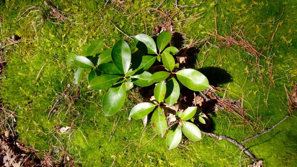
A little Mtn. Laurel grows on the thick moss near Rich Mtn.
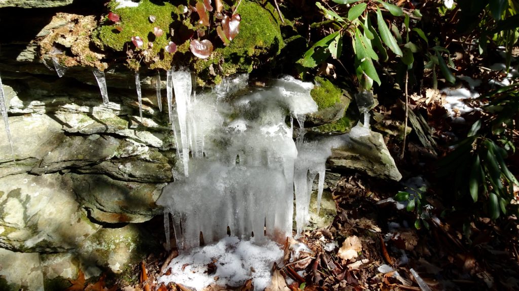
Icicles cling to a ledge on Crooked Arm Creek
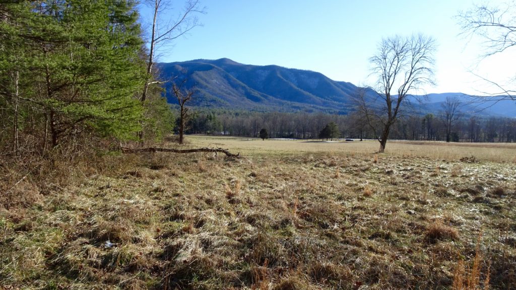
Quiet Cades Cove in winter is a true delight