Topo Tips #1
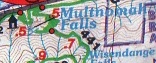
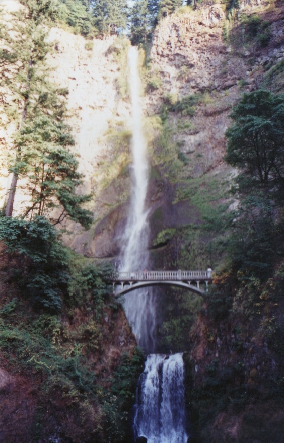
Ok, I’ll start with one that probably everyone has seen, Multnomah Falls. You can see from the photo the steep walls behind the falls, now look on the Green Trails map bit and notice behind the .5 and the dash naming the falls back to the .9 part. Can you see how close the lines are together? That symbolizes the steepness of the walls, the closer together they are the more vertical the cliffs. You can see the arch of the cliff walls as well, showing the crease that water has carved over time. Also, around the .7 part you can see how the trail eases up on the climbing and enters the river canyon proper and follows it up stream. Each of the regular lines is 80 feet and the darker lines symbolize 400 feet. I encourage you to take a map out with you when you are out hiking, when you are at a viewpoint, pull it out and identify the characteristics of the landscape, distant peaks, river valleys. In time, map reading will be come a lot of fun and you can spend hours combing over your favorite trails or new ones. Enjoy!